All the photographs on this page were taken by me, except where
indicated. I'm South Yorkshire in my roots and in my speech. South Yorkshire
is the county where I live but the Derbyshire border is not far away.
Derbyshire has a strong hold on me, as on so many Sheffield people. This
page is a collection of photographs - and not very many of them - with
minimal text. I don't claim any more than that. Please see also the similar
pages on Staffordshire - less extensive than
this page - and 'The Sheffield
Dales' - more extensive than this page but no more than a brief
introduction.
1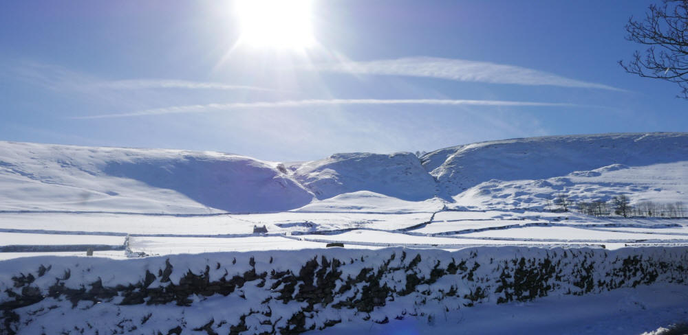
2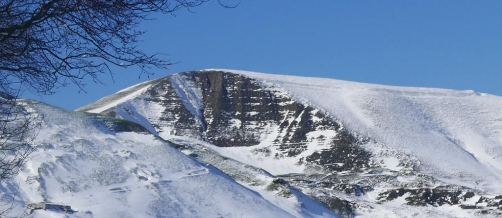
3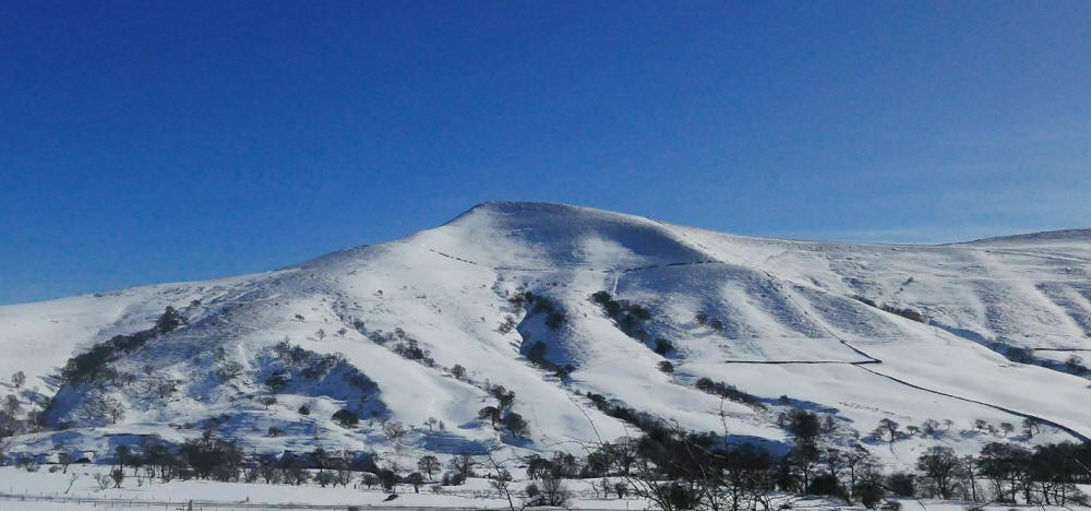
4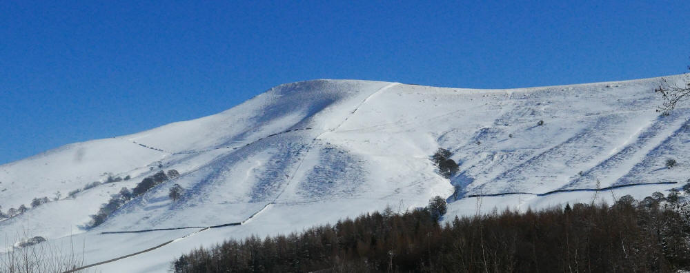
5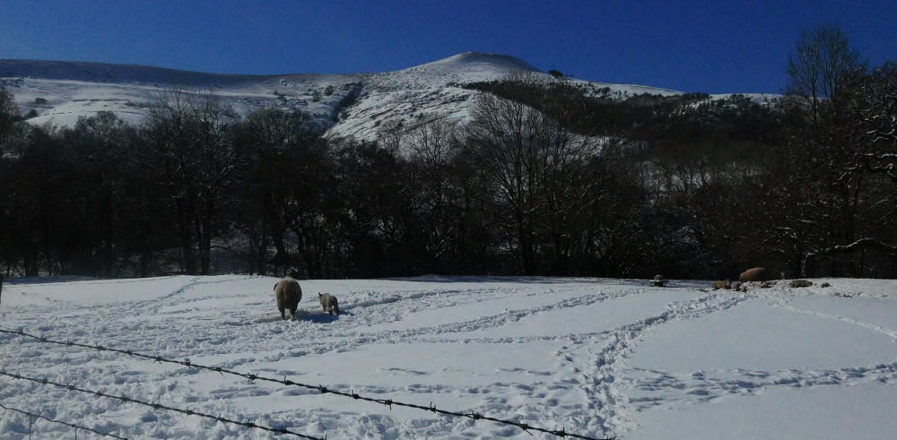
Derbyshire Peak District
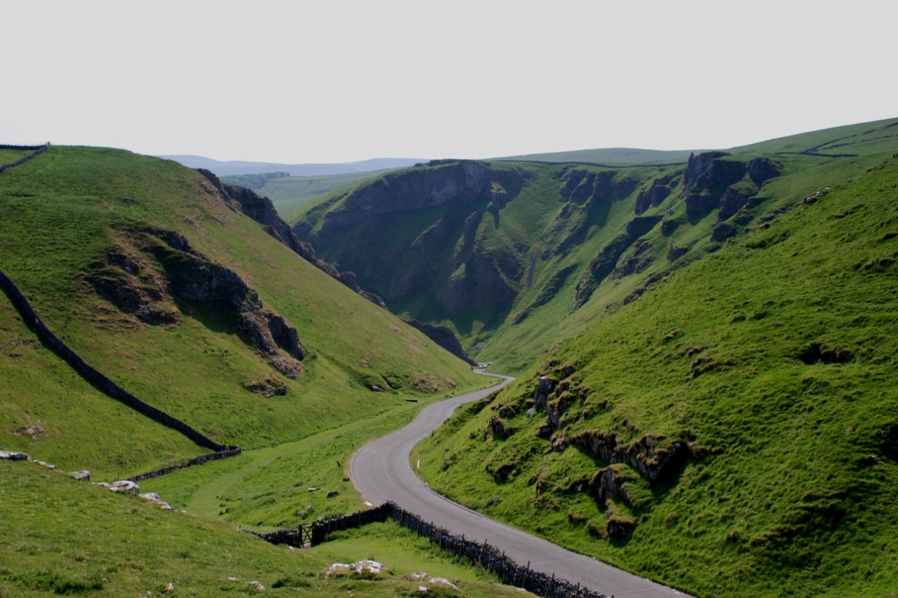
1. View from road
leading to Winnats Pass, Castleton
2. View of Mam Tor, near Castleton
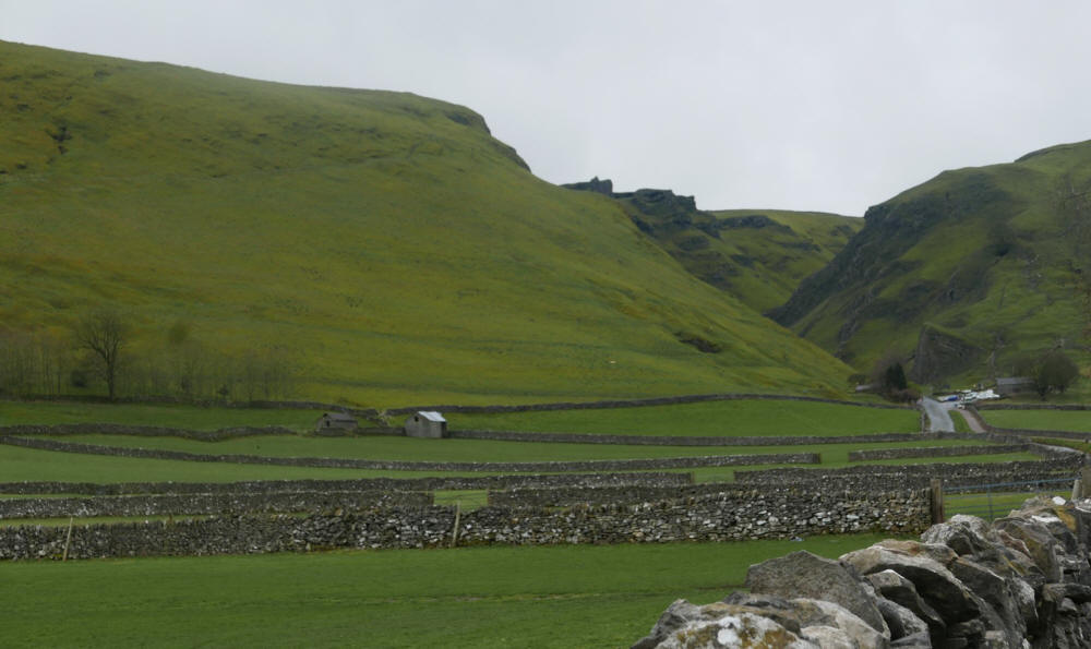
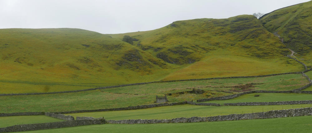
3, 4, 5. Views from Edale-Hope road
See also my page which includes (in the second and third columns) material on cross country skiing.
Other Derbyshire photographs:
Above, Winnats Pass, Peak District. Photograph not taken by me.
Above, photograph showing the road which leads to Winnats Pass and through the pass. Limestone visible everywhere, in outcrops
in the pass and in the dry stone walls, which contain Carboniferous fossils,
such as fossils of crinoid lilies. A substantial part of the area is a
designated Site of Special Scientific Interest (SSSI.) The geology of the
White Peak is very different from the geology of the Dark Peak, which
adjoins this area. The predominant rock of the Dark Peak is gritsone. At the
entrance to the pass, buildings of Speedwell Cavern, one of Castleton's four
show caves. The others are Peak Cavern, Blue John Cavern and Treak Cliff
Cavern.
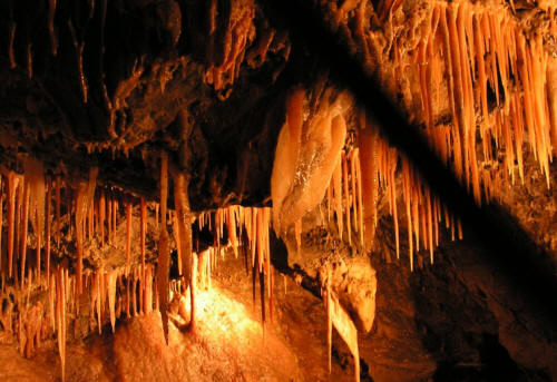
Speedwell Cavern is
one of the four show
caves in Castleton, Derbyshire, England.[1]
From the Wikipedia entry on Speedwell Cavern:
'The cave system consists of a horizontal lead miners' adit (a level passageway driven horizontally into the hillside) 200 metres below ground leading to the cavern itself, a limestone cave. The narrow adit is permanently flooded, so after descending a long staircase, access to the cave is made by boat. At the end of the adit, the cavern opens up with fluorspar veits, stalactites and stalagmites, and the so-called "Bottomless Pit". This chamber has an underground lake with a 20 metres (66 ft) high waterfall and an extremely deep vertical shaf ...The original depth of the shaft has been estimated, from the amount of spoil placed in the shaft over the years, at around 150 metres (490 ft).
'The mine was developed in the 1770s but the limited lead ore deposits meant that it was not profitable and it was closed down by 1790.
'At the foot of Winnats Pass, it is a tourist attraction with an underground boat trip to the cavern ...
'A connection was discovered in 2006 between the Speedwell Cavern system and Titan, the largest natural shaft in the UK, which is 141.5 metres (464 ft) high.'
When visiting any lead-mining area (almost always, an area where lead mining took place in the past), as when visiting any mining area, such as a coal-mining area, reflection is called for, in my view - an appreciation of the back-breaking, dangerous work of the miners, which only became less dangerous and less harsh with the technological advances which transformed mining.
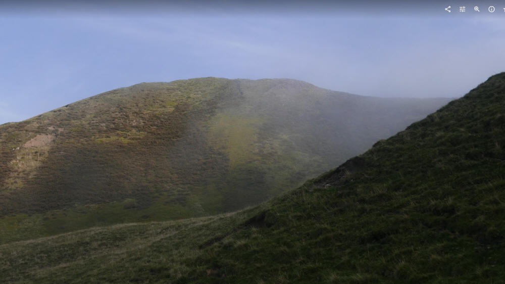
Above, photograph of area shown in Photograph 1, without snow cover.
Below, 3 photographs showing the road from Castleton to Edale, which climbs and falls. Views of scenery, a sheep and the road during the descent.

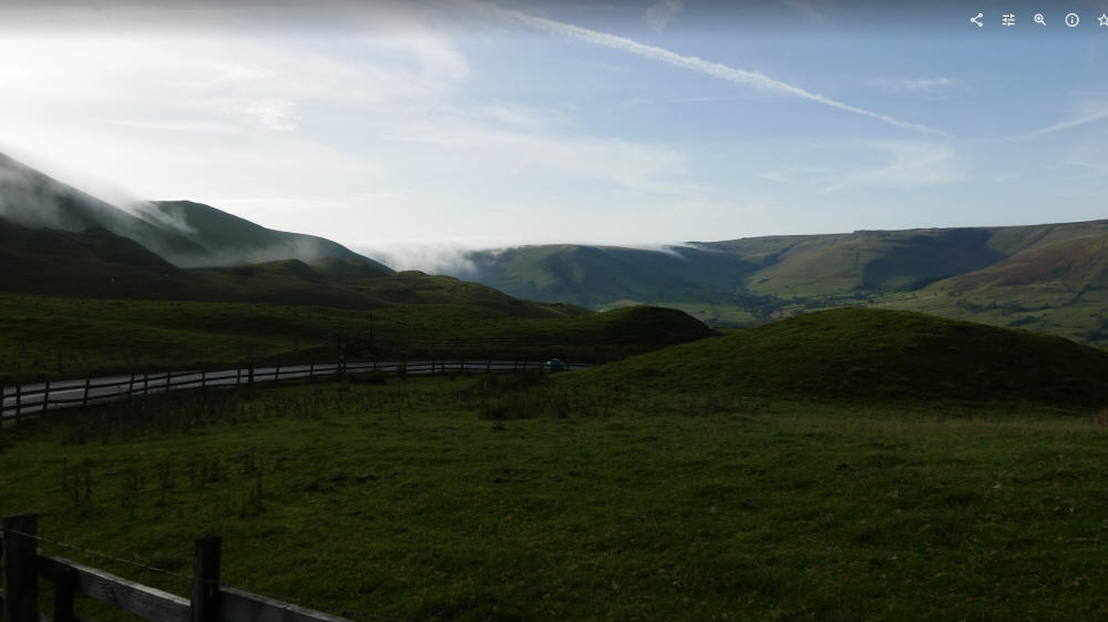
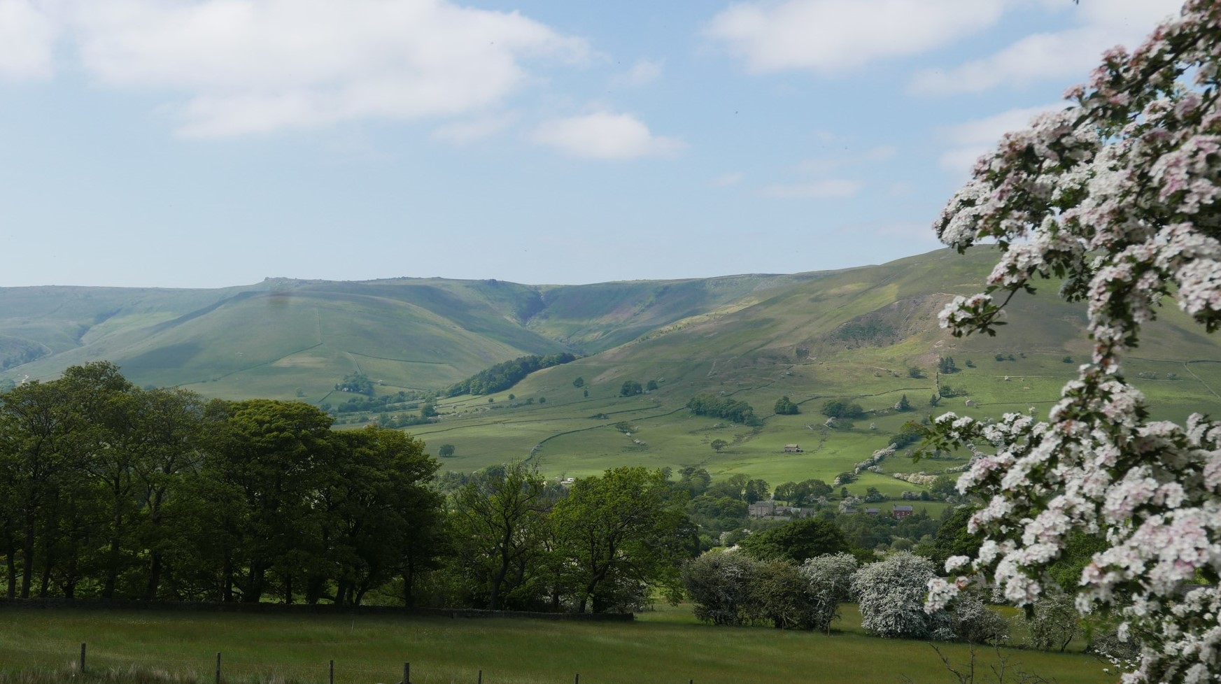
Above, the Dark Peak lightened. View after going down the road from Castleton, towards Edale, with woods - and hawthorn blossom.
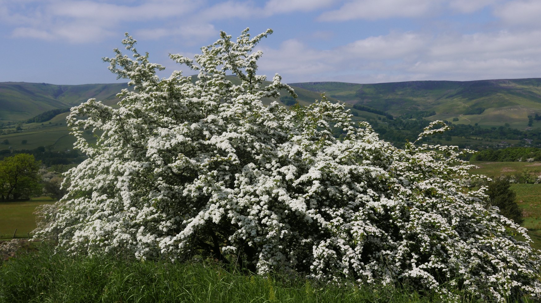
Above, Dark Peak hills hidden behind hawthorn.
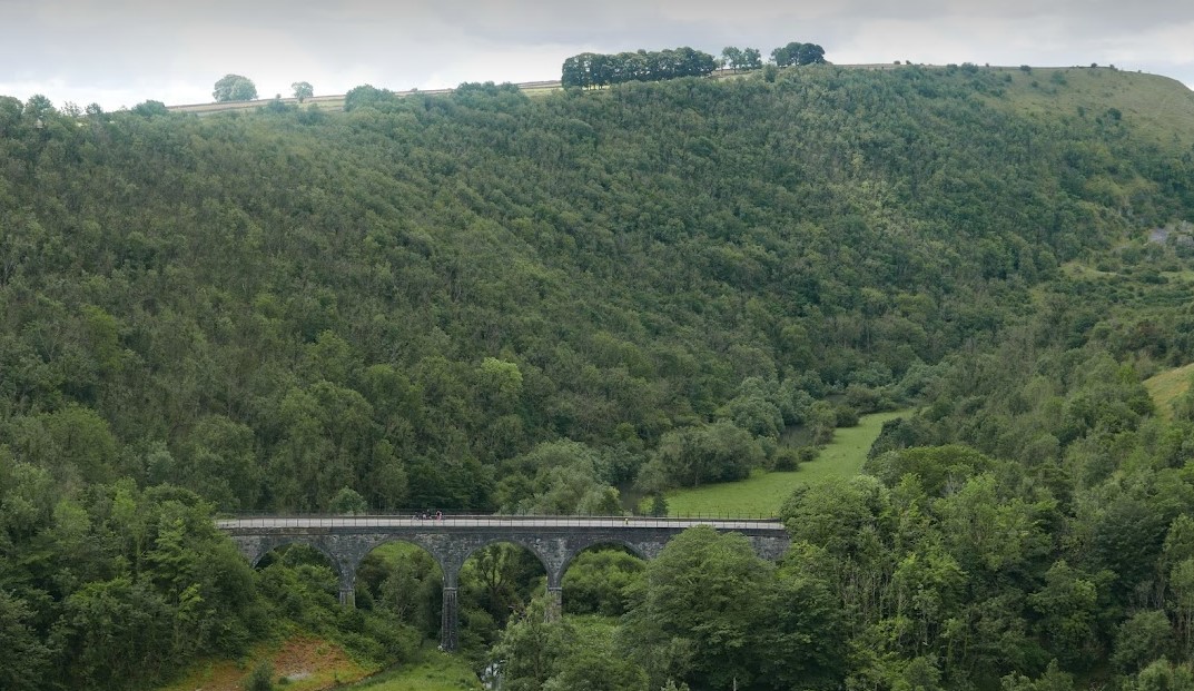
Above, further afield: the Headstone Viaduct in Monsal Dale, crossing the River Wye. The viaduct is near the Headstone tunnel. The line is no longer part of the railway network but is part of the Monsal Trail, used by walkers, horse riders and cyclists.
Next photographs not taken by me.

Above, view of the illustrious Hope Valley from Stanage Edge

Above, the Salt Cellar, a tor (rocky outcrop) at Derwent Edge in the Dark Peak. The geology of this area is millstone grit, which originally covered all the Peak District. Most of it was removed by glaciers in the last Ice Age. The millstone grit remains in this area and makes up the edge of a peaty moorland plateau above Ladybower Reservoir, visible in the image.
The Salt Cellar is one of the unusual gritstone tors shaped by wind, rain and frost over that have been formed by the actions of wind, rain, and frost. Others are the Cakes of Bread and the Coach and Horses. This area is not far from the Sheffield border.

Above, very near the border with Staffordshire, in the valley of the River Dove: Chrome Hill, to the left Parkhouse Hill.
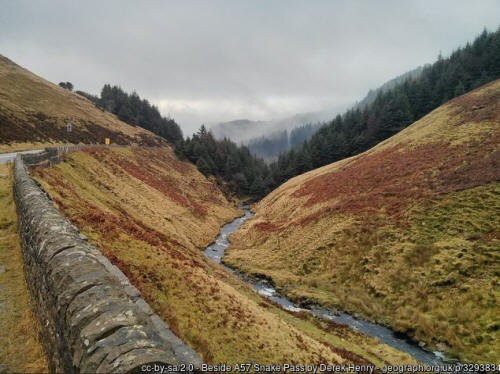
Above, the Snake Pass is a main road through the Derbyshire Peak District, between Glossop and the Ladybower Reservoir.
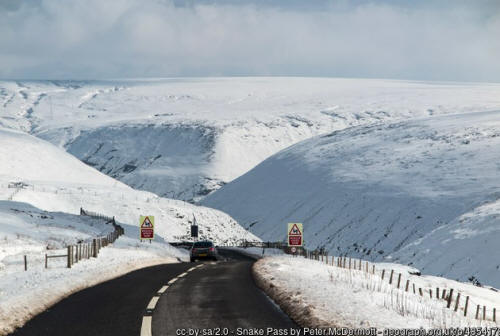
Above, the summit of the Snake Pass in winter, in conditions which aren't very harsh - the road is still open for vehicles to use. The elevation, 512 metres (1,680 feet) is enough to give deep snow in some winters. A very long time ago, when I lived in Marple, Cheshire and was visiting Sheffield, I decided to walk back to Marple over the Snake Pass. The Pass can't be used by pedestrians in most conditions. The road is narrow and the traffic heavy. This is one of only two main roads between Sheffield and the Manchester area. I was glad to have the chance to walk the route. This was years before I took up cross-country skiing but already, I had an affinity for snow.

Above, part of Ladybower Reservoir at dawn. This photograph, and the photograph above, not taken by me. The road leading from Sheffield to Ladybower rises steadily and then there's a downhill section, leading to Ladybower Reservoir. The border between Sheffield is in the higher section. Walking from Sheffield - or taking the easier way, driving from Sheffield - the walker (or driver) follows the road by the shoreline, not taking the branching road over the bridge, which leads towards the Derbyshire village of Bamford and then a road which leads to Hathersage, to the left, and the villages of Hope and Castleton to the right. After Castleton, a steep road leads to Edale, the start of the Pennine Way.
Below, a striking feature of the reservoir, a 'plughole.'

The main road by the shoreline climbs and climbs. This is the Snake Pass, and was the route I followed to get to Glossop, Derbyshire. Following another road, the Derbyshire-Cheshire border is reached, and was the route I followed to reach Marple, Cheshire.
Supplementary: On reaching Marple, another pleasant walk can be taken - from Marple to Manchester city centre, along the canal path. This is a scenic route and a very informative route, giving an appreciation for the massive achievements of the canal age, the railway age which followed and the growth of industrialization, in particular, the textile industry. This is a more relaxing route than the Snake Pass in winter - for one thing, the route is level during almost its full length, whilst the Snake pass route has long ascents as well as descents and can only be taken along its full length in winter, although this may change.
The road is quite often closed to vehicles by snow and can be closed for long periods by road subsidence. Parts of the route are subject to precarious geological conditions. The problem is acute now, the local authority not being able to find the money to carry out repairs to solve the problem. It's possible that the route will be closed to traffic permanently, and open to walkers and cyclists permanently.
The walk from Sheffield to Marple took me 10 hours. The walk from Marple to Manchester city centre used to take me about 4 hours.
This is a view of the wondrous Marple Aqueduct, which carries the canal high above the River Goyt. Clearly visible from the aqueduct, but not shown in this image, is the railway bridge, also very high. The aqueduct is the highest canal aqueduct in England and the highest aqueduct built of stone in Britain.

Below, a view of the aqueduct which shows the railway bridge as well

Above, the Blue John Cavern, Castleton. Blue John: a rare form of the mineral fluorite, mined only at the Blue John Cavern and the Treak Cliff Cavern, also in Castleton.
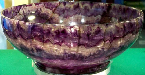
Above, bowl made of Blue John
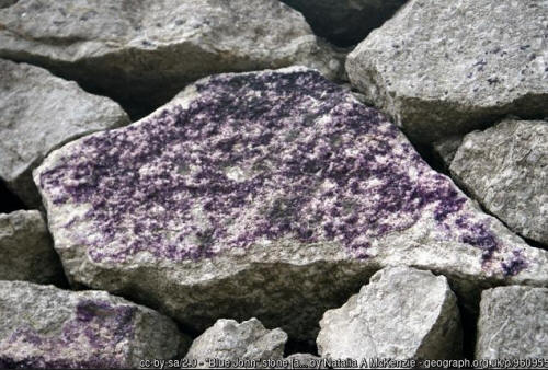
Above, Derbyshire dry stone wall with stone containing Blue John
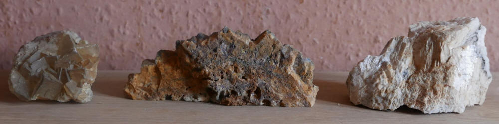
Above, minerals of mine, photographed by me. Left, fluorite from Treak Cliff Cavern, Castleton. Centre, fluorite with barite, galena and iron from Treak Cliff Cavern. Right, from outside the Peak District - dolomite and calcite, from the Harding vein, Carrock mine, Cumbria.
For the minerals of the Midlands, 'Minerals of the English Midlands' by Roy E. Starkey is a superb guide.
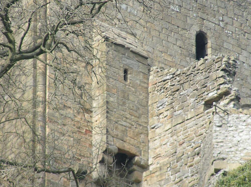
Above the Keep of Peveril Castle, high above Castleton. The Keep was begun c. 1176. Photograph not taken by me.
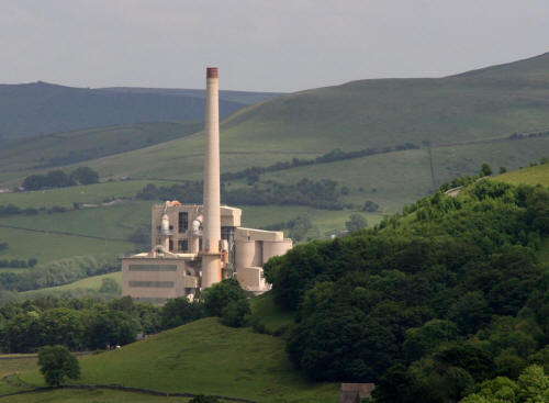
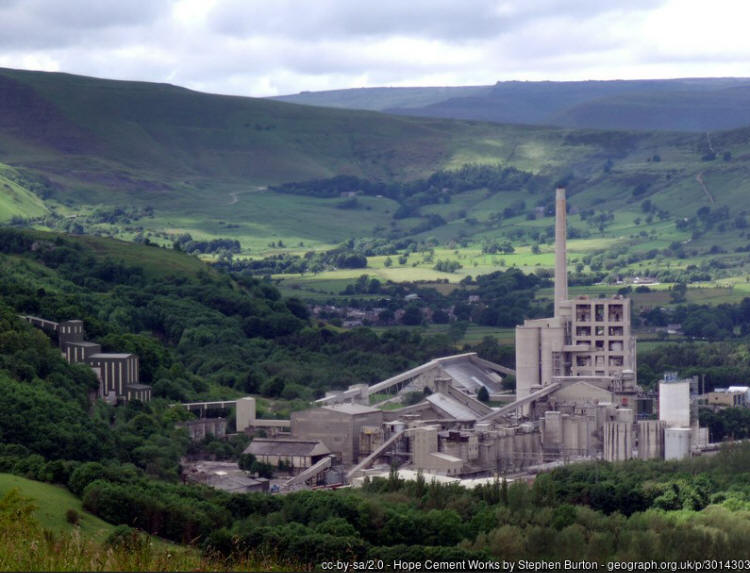
Above, Hope Cement Works, the largest in the UK. Hope, Derbyshire, is near to Castleton. Photographs not taken by me. The Peak District Mountain Rescue team is based at the cement works. The raw materials needed for the plant's operation are available nearby. I approve of the Cement Works - more exactly, I respect and admire the achievement, the construction, the day to day production of an essential building material. (Derbyshire building stone is a strong interest of mine too, as used in the construction of dry stone walls, vernacular architecture and larger architectural forms.) The setting of the cement works is very attractive. The cement works itself could be regarded as large-scale modernist architecture, almost. The tall rectangular structure next to the chimney isn't essentially different from many modern buildings designed by architects.
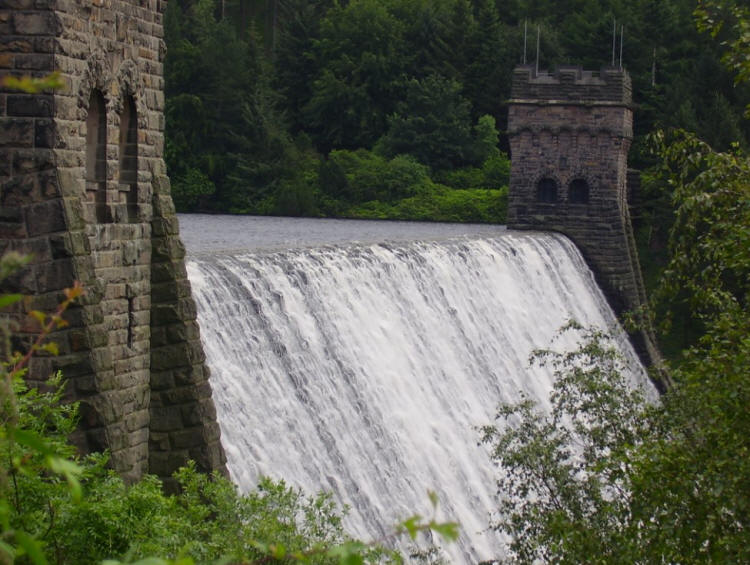
Above, Derwent Reservoir
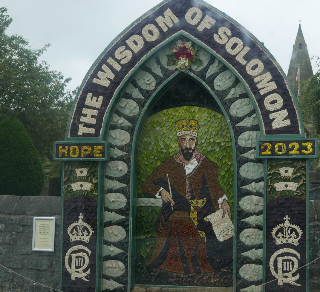
Above, well dressing in the village of Hope, 2023. Well dressing takes place on a limited scale in some other places, but Derbyshire is by far the most prominent place where well dressing takes place, appearing in succession throughout the summer months. The displays are constructed by pressing flower petals and other natural materials onto clay and are obviously transient.
Extract from
the entry on the very valuable and informative Website, 'British Listed
Buildings'
https://britishlistedbuildings.co.uk/101068603-the-old-manse-and-attached-garden-walls-great-hucklowBritish Listed Buildings
'House. Mid C18. Coursed squared limestone with
gritstone dressings and
rusticated quoins
... Steeply pitched C20
concrete tile
roof and stone coped gables with moulded kneelers. Stone gable
end stacks with plain banding. Central pedimented Doric
pilastered doorcase with raised
and
fielded panelled door. To either side 3-light square sectioned mullion
windows. Two similar over with two more above to eaves. All
fenestration C20.'
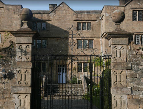
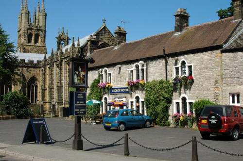
Above, Eyam Hall.
From Pevsner, 'The Buildings of England, Derbyshire:'
'Dated 1676 on a rainwater head ... The front is a half-H with the sides projecting far. It is three stories high with string-courses sharply dividing the storeys rom each other and a straight top interrupted by three small gables ... The windows are low and mullioned of three and small lights, symmetrically arranged, and touch the string courses with their tops. This latter feature as well as the comparatively classical door surround tally with the date 1676.'
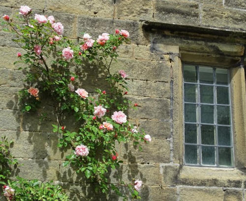
Above, window and wall, Eyam. Photograph not taken by me.
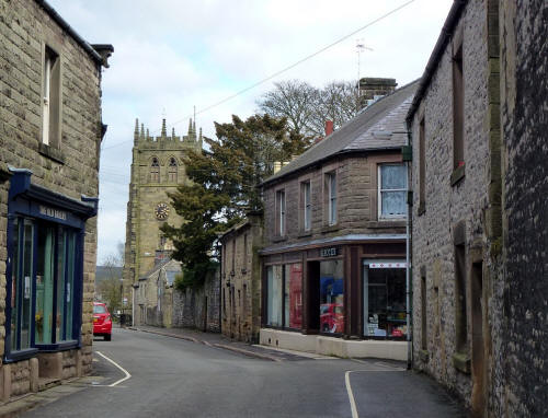
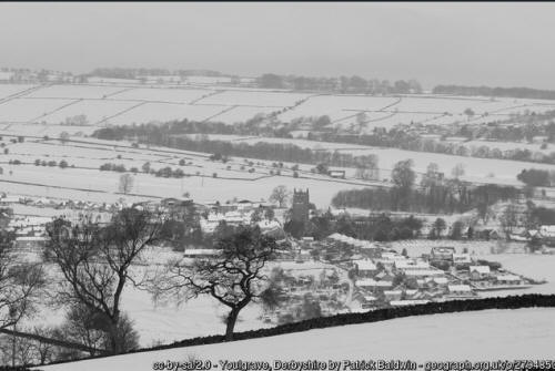
Above, two views of Youlgreave and a view of Tideswell, both wonderful places to live, I'm sure, although I've never lived in either, certainly wonderful places to visit. These photographs not taken by me.
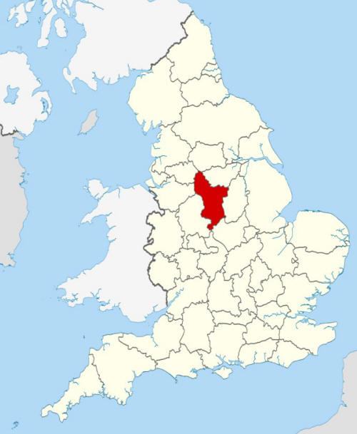
Above, location of County of Derbyshire
Amongst its achievements, Derbyshire is a county of magnificent industrial achievement. To represent this achievement by just a very few images is a travesty, but this is obviously not intended to be a full or partial survey of the county. These images show places in Derby. None of these photographs were taken by me. North Derbyshire is the part of Derbyshire I know best, by far, but the 'midlands' area of Derbyshire and southern Derbyshire are full of interest. I'm in no danger of neglecting them.
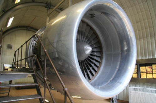
Above, a Rolls Royce RB211 jet engine in the 'Museum of Making,' Derby. A very interesting article, 'RB.211- The Engine That Sank and Then Saved Rolls Royce.'
https://curious-droid.com/1462/rb-211-the-engine-that-sank-and-then-saved-rolls-royce/

Above, former Rolls Royce factory
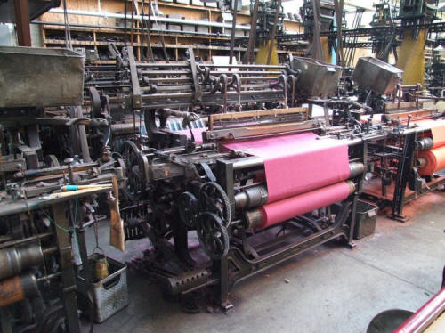
Above, a reminder of the astonishing industrial achievement of the Cromford area, specifically Masson Mill: Yorkshire broadloom machinery.
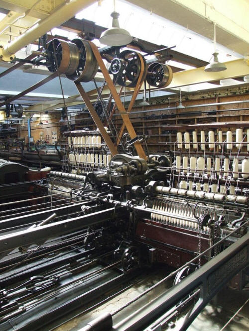
More machinery from the Masson Mill, for the spinning operation.
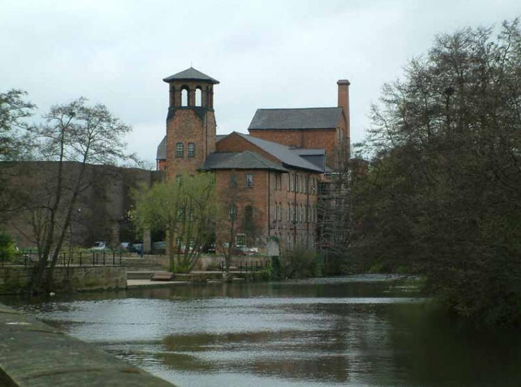
Above the Derby 'Museum of Making,' housed in Derby Silk Mill, part of the Derwent Valley Mills World Heritage Site.

![]()